|
|
TRAILS
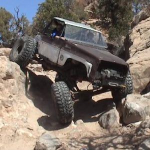
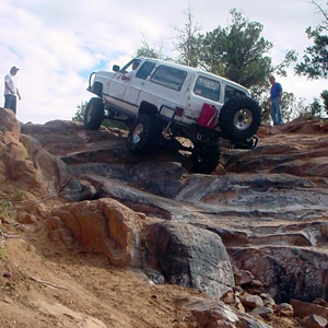
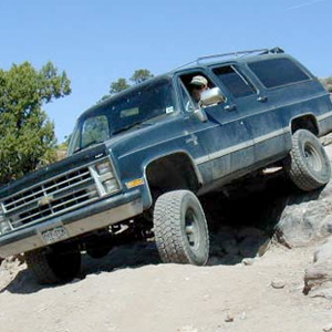
General: mandatory for each trail category: solid tow points front and rear; seat belts for all occupants of the vehicle; fire extinguisher; tow strap; working jack; vehicle in good overall working order, brakes in excellent condition, no leaks; motor must keep running at steep angles. Highly recommended: first aid kit, CB radio
Trails - Easy: stock suspension or mild lift, tires 31-33" or higher
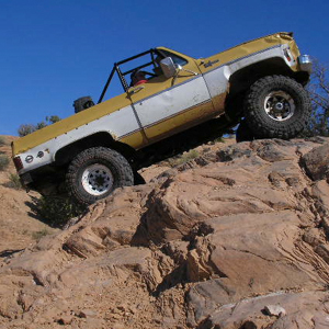
Trails - Difficult: tires 33-35" or higher, one locker, two is better
Trails - Hardcore: tires 36"+, two lockers mandatory, winch
General Notes: Participants are required to sign a waiver for the event. On each trail ride, we will have experienced �wheelers that are familiar with the trail and each obstacle. If you�re not sure about the right line in an obstacle, please ask for spotting help. We tend to prefer overbuilt vehicles, particularly on runs with many participants. Furthermore, breakage is not cool. Since we will leave no one behind, if your vehicle suffers a break on the trail, it will delay the entire group. This cuts into the trail experience of others that want to make the most of their precious time in Moab. And given the sensitive environmental nature of the area, leaks or leaking vehicle fluids due to a break are absolutely not cool.
Please, be considerate, and prepare as well as drive your vehicle accordingly. Finally, please be advised that each trail leader has the final decision authority over whether a vehicle will be allowed to join a run.
TRAIL
DESCRIPTIONS
|
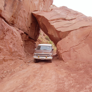
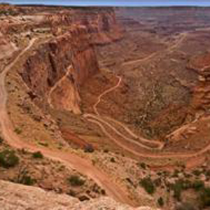
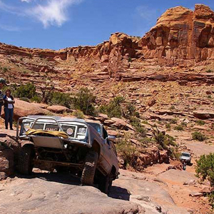
Hell�s Revenge (difficult)
Distance: 8.5 miles
Obstacles: Hell�s Gate, Bath Tub, Car Wash, Mickey�s Hot Tub, Escalator, Tip-Over Challenge
Description: Hell�s Revenge is located close to town (Moab) which makes it easy to get to. This is a very intimidating trail but it is not technically challenging unless you choose to attempt the optional obstacles such as the Escalator. The trail winds its way up and over tall slickrock fins with breathtaking views and white knuckle ascents and descents. This is one of the most popular trails in Moab and it�s a �must-do� trail.
Notes: Trail use fee at the entrance is required. |
 |
|
 |
Metal Masher
(Difficult)
Distance: 10.64 miles
Obstacles: Rock Chucker, Mirror Gulch, Widowmaker, Mother-In-Law Hill
Description: From Hwy 191 north of Moab to the top of Arth�s Rim, this trail features several slickrock areas and some rough terrain, and a fabulous view of Arches National Park from the top. Ledgy climbs such as one through Mirror Gulch demand attention to the correct line and a reliable vehicle. The two big (but optional) obstacles are Rock Chucker Hill and Widowmaker, and Mother-in-Law Hill offers several lines of varying degree of difficulty on the way out. |
|
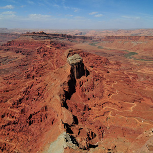
Gold Bar Rim (Difficult)
Distance: 3.8 miles
Obstacles: Slide Rock
Description: Located in the same area as several other trails including Metal Masher, Gold Bar Rim is a short fun trail consisting of several ledge climbs that get more difficult towards the end. An obstacle called many different things including Slide Rock, marks the beginning of the difficult section. This is also the location of Jason Payne�s memorial plaque. The top of the trail has a magnificent overlook providing a 360� view of the entire Moab area. Gold Bar Rim is the tail end of the Trifecta run for Saturday. |
 |
|
 |
Seven Mile Rim (Easy)
Distance: 10.7 miles
Obstacles: Big Ledge, Butte Ledges, Tippy Slickrock, Silver Crack
Description: Seven Mile Rim is mostly sandy, two-track dirt road. It does provide a few challenging obstacles and some terrific scenery that we all come to Moab to enjoy. There is an opportunity to see Uranium Arch and drive around some majestic buttes called the Monitor and the Merimac. The trail also features a smaller version of the infamous Golden Crack; Seven Mile Rim�s crack is called the Silver Crack. |
|
Flat Iron Mesa � backwards (Difficult)
Distance: 14.8 miles
Obstacles: Rubble Hill, the Dome, Tilt-A-Whirl, Easter Egg Hill, the Squeeze
Description: This trail provides a good mix of easy and challenging obstacles. Much of the trail winds around the area as a two-track, sandy dirt road. There are sections of slickrock and ledge climbs. Running the trail backwards will provide some additional ledge climb challenges. Tilt-A-Whirl is a challenging off-camber turn that requires careful tire placement and steady nerves, but this is just a warm up for the tension created at the Squeeze. The Squeeze is a tight turn with a rock outcropping on one side and a sheer drop off on the other. Both obstacles mentioned can be bypassed. |
 |
|
 |
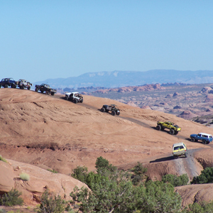
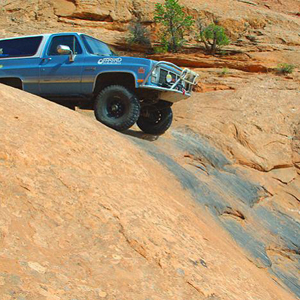
The "Trifecta": Poison Spider Mesa-Golden Spike-Gold Bar Rim (Hardcore)
Distance: 19 miles (approximate)
Obstacles: Chutes, Big Ledge, Prelaunch Pad, Waterfall, Wedgy, Sand Bowl, Tippy Dome, Launch Pad, Skyline Drive, Witch's Crotch, Washtub, Zuki Hill, Golden Crack, Buggy Challenge, Golden Stairs, Golden Coaster, Double Whammy, Body Snatcher
Description: The Trifecta is the ultimate Moab wheelin' experience as it encompasses 3 trails with numerous challenging and fun obstacles. Everyone needs a picture of their rig on the Golden Crack and this best opportunity to get it done. Plan on a LONG day for this trail, but you won't regret a minute of it. In order to help us get everyone off the trail before dark, please keep in mind this trail is only for the most prepared vehicles. Minimum 35" tires & 1 locker required. The trail is rated "Hardcore" due to its length and numerous obstacles. |
|
Pritchett Canyon (Hardcore)
Distance: 19 miles (approximate)
Obstacles: Which Way, The Tube, Damen's Hot Tub, Rocker Knocker, Suicide Hill, Rock Pile, Yellow Hill
Description: It�s only 4 miles, but make no mistake about it: they are among the 4 hardest miles in Moab. The entry is tricky, and obstacles such as the Rocker Knocker, Rock Pile, Suicide Hill, and Yellow Hill, are known to take a bite out of vehicles quite often. Come well-prepared: 2 lockers, 36+ tires and a winch are mandatory. Most importantly: make sure your motor keeps running when the truck�s nose points towards the sky.
Notes: Trail use fee at the entrance is applicable. |
 |
|
 |
Shafer Trail Switchbacks (Easy)
Distance:
Obstacles:
Description: The switchbacks are an easy trail that only requires high clearance, so this is a trail that could be done in the tow rig. The Shafer switchbacks are a series of steep and amazing switchbacks cut into the side of a canyon It boasts a breathtaking view, but may not be a comfortable experience for people with an extreme fear of heights. At the bottom of the switchbacks you can access Musselman Arch and much of the White Rim trail.
Notes: Canyonlands National Park entrance fee is applicable |
|
Strike Ravine (Difficult)
Distance: 6.3 miles
Obstacles: Big Ugly
Description: This trail consists of some rugged canyons with loose, rocky hill climbs and canyon bottoms with several ledges and boulders. There are some �sneaky� rocks that can catch your sheetmetal by surprise. The trail ends at the Area BFE trailhead/parking area. |
 |
|
 |
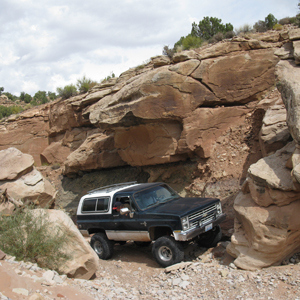
Area BFE
Distance: Varies
Obstacles: Depends on the trail
Description: This is a privately owned area full of trails. The trails range from difficult to extreme. A few of the trails are Green Day, Black Flag, Minor Threat, and many more. There are also several �playgrounds� where you can test out your vehicle. There is something in the area for any vehicle. Entrance is free to the public, but they do accept donations.
Notes: none. |
|
Behind the Rocks (difficult)
Distance: 29 miles
Obstacles: White Knuckle Hill, Roller Coaster, Hummer Hill, High Dive, Upchuck
Description: On this trail you will find 2 of the hardest obstacles in Moab, High Dive and White Knuckle. High Dive can be easily bypassed however to bypass White Knuckle you must travel several mile. There are many more challenging spots on this trail. There are also several scenic spots along the trail.
Notes: none. |
 |
|
 |
Cliff Hanger (difficult)
Distance: 4.3 miles one way, 8.6 miles total
Obstacles: Z-turn and many big ledges & challenging obstacles
Description: This trail is both scenic and challenging. You drive in to the end at an overlook and then turn around to drive back out on the same trail. There are thrilling views as you drive along a ledge up above Jackson Hole. There are many unusual and spectacular views along the trail.
Notes: none. |
|
Hurrah Pass/Chicken Corners (easy)
Distance: 19.4 miles total
Points of Interest: Birthing Rock petroglyphs, Catacomb Rock, Thelma & Louis Point
Description: Make sure you camera batteries are fresh before you set out on these 2 extremely scenic trails run in series. There are several scenic overlooks along both trails. The trails are easy with a few rocky sections easily conquered with a stock vehicle.
Notes: none. |
 |
|
 |
Tip Toe Behind the Rocks (easy)
Distance: 33 miles
Obstacles: Roller Coaster & Hummer Hill
Description: Tip-Toe allows participants to view the High Dive, Upchuck, and White Knuckle Hill obstacles of the more difficult Behind the Rocks with much less risk of damaging their vehicles. There are a few minor drainage crossings with exposed rock ledges that will require some attention to climb with stock equipment. Tip-Toe crosses Behind the Rocks and even shares some of the easier sections for short distances.
Notes: none. |
|
Hey Joe Canyon (moderate)
Distance: 26 miles
Obstacles: No named obstacles
Description: Trail begins with Spring Bottom Canyon which is a very scenic and beautiful trail. This picturesque trail is often overlooked by visitors to the Moab area, but it is worth the trip for the spectacular views. Near the end of the trail you take a breathtaking descent down a ledge road to the river, once at the bottom it�s an impressive sight with the canyon walls towering overhead. Next you head into Hey Joe Canyon which is narrow trail that runs right next to the river. Because this trail is narrow, enclosed on both sides by tamarisk bushes, this is not the trial for fancy paint jobs. The beginning of the trail is just a few feet from the river. The end of the trail has some interesting rock to negotiate leading up to the Hey Joe mine. There is some abandoned mining equipment, but the mine are is not open for exploration. At this point you must turn around and drive back out the entire length.
Notes: 20 miles of highway driving to the trail (one-way), making for a total of nearly 70miles full trip. |
 |
|
 |
Steel Bender (Difficult)
Distance: 15 miles (plus 15 highway miles)
Obstacles: The Wall, Dragon's Tail
Description: This is a fun, challenging trail. There are many rock ledges to climb with some sandy sections to make things a little more interesting. The trail runs through two parts of beautiful Mill Creek Canyon and other portions overlook the
Canyonlands. |
|
Kane Creek Canyon (Difficult)
Distance: 20 miles (plus 18 highway miles)
Obstacles: None
Description: Not your typical Moab trail. Kane Creek includes lots of water crossings and shade. You follow a canyon bottom with large mesas on both sides. Working your way into the canyon, the views are spectacular as you approach several obstacles, some can be bypassed. There is a steel hill climb consisting of loose rock & dirt. Following the creek bottom you cross the creek so many times you'll lose count and for some of the trail you are driving in the creek. There is another rough, rocky hill to climb to get out of the trail. |
 |
|
 |
3-D (Easy)
Distance: 28 miles (plus 21 highway miles)
Obstacles: Airport View Hill, The Wall, Mean Hill
Description: 3-D navigates the area northwest of Moab in the vicinity of Hidden Canyon & Brink Spring. You will encounter a canyon bottom, canyon rim, and eventually a higher overlook of the area giving the trail its name, 3-D. A few sections may challenge a stock vehicle, but for the most part it is a pleasant scenic day on the trail. |
|
Fins 'n' Things (Easy)
Distance: 13 miles (plus 12 highway miles)
Obstacles: Frenchie's Fin, Ken's Climb
Description: "Fins" are tall, narrow Navajo Sandstone slickrock and "things" are the eroded remains of fins. The trail is located northeast of Moab near Hell's Revenge. There are a few steep, sudden climbs on and off the fins that can be difficult for vehicles with long overhangs. Loose sand throughout the trail offers some additional challenge. There is an entrance fee for the Sand Flats area. |
 |
|
 |
Poison Spider Mesa (Difficult)
Distance: 16 miles (plus 11 highway miles)
Obstacles: The Waterfall, Wedgie
Description: This trail loops out to a rim overlooking the Colorado River. The trail has great scenery and it is challenging enough to be fun without feeling like your about to break your vehicle. The trail consists of slickrock, rock ledges, sandy washbottom, and blow-sand hills. |
|
More information on these trails can be found on the following websites:
http://www.traildamage.com/trails/index.php
http://www.centralpt.com/pageview.aspx?id=20715
|